Local Knowledge: What I learnt from creating a mobile app to find my local historic buildings
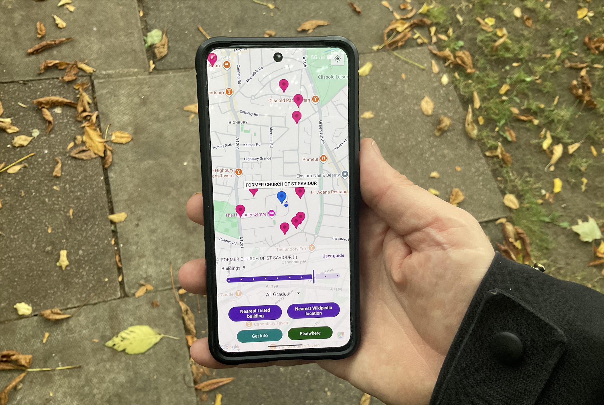
Into the past. Despite having lived in the Highbury area of London for a few years, I realised I did not know what my local historic buildings were. It’s not that I didn’t have suspicions about what they might be. To address this, I created an Android mobile app using publicly available information on listed historic buildings in the UK and the Republic of Ireland. The idea was to link the phone’s location to nearby historic buildings and display relevant information directly within the app.